Hazaribagh is a city and a municipality in Hazaribagh district in the Indian state of Jharkhand. It is the divisional headquarters of North Chota Nagpur division.
Etymologially, the word Hazaribagh is made of two words, hazar meaning 'thousand', and bagh meaning 'garden'. Hence the literal meaning of Hazaribagh is 'City of thousand gardens'. According to Sir John Houlton the town takes its name from the small villages of Okni and Hazari – shown in old maps as Ocunhazry. The last syllable in its name probably originated in a mango-grove, which formed a camping ground for troops and travellers marching along the 'new military road' from Kolkata to Varanasi, constructed in 1782 and the following years. The Grand Trunk Road subsequently replaced this military road in the mid-eighteen hundreds, but the lay out differed at places, particularly around Hazaribagh. A dilapidated watch tower meant to guard the military road is still visible on Tower Hill, near Silwar.
History
In very early times the district was covered with inaccessible forests to which non- Aryan tribes who refused to surrender to the steadily advancing Aryans, retired at different times. The entire territory of Chhotanagpur, known as Jharkhand (meaning forest territory) was presumably beyond the pale of district Hindu influence in ancient India. (However, there was a small kingdom or principality, head quartered at Kharagdiha. It was perhaps established by one Hansraj. The rulers, perhaps, were extension and remnaints of Sena rulers of Bengal.This kingdom was later on taken over by Shershah). Though out the Turko-Afghan period (up to 1526), the area remained virtually free from external influence. It was only with the accession of Akbar to the throne of Delhi in 1556, that Muslim influence penetrated Jharkhand, then known to the Mughals as Kokrah.
In 1585, Akbar sent a force under the command of Shahbaj Khan to reduce the Raja of Chotanagpur to the position of a tributary. After the death of Akbar in 1605, the area presumably regained its independence. This necessitated an expedition in 1616 by Ibrahim Khan Fateh Jang, the Governor and brother of Queen Noorjehan. Ibrahim Khan defeated and captured Durjan Sal, the 46th Raja of Chotanagpur. He was imprisoned for 12 years but was later released and reinstated on the throne after he had shown his ability in distinguishing a real diamond from a fake one.
In 1632 Chotanagpur was given as Jagir to the Governor at Patna for an annual payment of Rs. 136000. This was raised to Rs. 161000 in 1636 A.D. During the reign of Muhammad Shah (1719-1748), Sarballand Khan, the Governor of then Bihar, marched against the Raja of Chotanagpur and obtained his submission. Another expedition was led by Fakhruddoula, the Governor of Bihar in 1731. He came to terms with the Raja of Chotanagpur. In 1735 Alivardi Khan had some difficulty in enforcing the payment of the annual tribute of Rs. 12000 from the Raja of Ramgarh, as agreed to by the latter according to the terms settled with Fakhruddoula. This situation continued until the occupation of the country by the British. During the Muslim period, the main estates in the district were Ramgarh, Kunda, Chai and Kharagdiha. Subsequent to the Kol uprising in 1831 which, however, did not seriously affect Hazaribag, the administrative structure of the territory was changed.
The paraganas Ramgarh, Kharagdiha, Kendi and Kunda became parts of the South-West Frontier Agency and were formed into a division named Hazaribag as the administrative headquarters. In 1854 the designation of South-West Frontier Agency was changed to Chota Nagpur and it began to be administered as a Non-regulation province under the Lieutenant Governor. In 1855-56 there was the great uprising of the Santhals against the British but was brutally suppressed. After 1991 census, the district of Hazaribag has been divided into three separate districts viz. Hazaribag, Chatra and Koderma. The two sub-divisions namely Chatra and Koderma were upgraded to the status of independent districts. Later in 2007, the sub-division of Ramgarh was also upgraded to the status of independent district.
Town
The town became a cantonment in 1790, the Ramgarh battalion having been raised ten years earlier. It was then part of Ramgarh. It became a district headquarter in 1834. The cantonment flourished till 1884. One of the beneficial results of the town being a cantonment was the laying out of a large part of the town according to regular plan. This part of the town is known as Boddam Bazar, after the officer who laid it out. Many Englishmen settled in Hazaribagh during the British period. They built large bungalow type houses, quite often with sloping roofs. Many of them were great hunters and hunting stories abound in the town by word of mouth. Most of them left after independence. A century back it was common for tigers and leopards to poach upon livestock in the outskirts of the town.
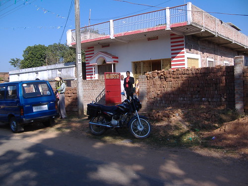
A Typical Modern House in Hazaribag
Hazaribagh Central Jail housed many leaders of the Indian freedom movement, including Dr. Rajendra Prasad, later the first president of India. The popular leader Jayaprakash Narayan was put under arrest in this jail during the Quit India Movement of 1942. His escape from this high security prison and the support he received from the local people is one of the legends of the Indian Independence movement.
Ramgarh is a cantonment town about 50 km from Hazaribagh. The 53rd session of the Indian National Congress was held at Ramgarh in 1940. Ramgarh Cantonment railway station is on the Barkakhana-Muri section. Ranchi Road railway station, near Ramgarh is on the Barkakhana-Gomoh section. Situated on the banks of the Damodar River, it is also a major centre of coal mining activity. In recent years there has been a spurt in the coalmining activities in the region by Central Coalfields, a subsidiary of Coal India Limited. This is benefitting Hazaribagh economically. Damodar Valley Corporation has a number of offices in Hazaribagh.
Hazaribagh does not have a railway connection but is well connected by bus service with Ranchi, Dhanbad, Patna, Gaya, Daltonganj, Koderma, Chatra and other major towns in the region.
Educational centre
The cool climate and the quiet environs of Hazaribagh attracted educationists to set up institutions in the town. The Dublin Mission has a big presence with educational institutions and a women's hospital. Activities of the mission were started at Hazaribagh in 1890, under the aegis of Trinity College, Dublin, Ireland. St. Columba's college was one of the oldest. A.F.Markham attached to the college for many years was a legend in his life time. He later became vice chancellor of Ranchi University.
St. Columba's College, Hazaribag
The Roman Catholics have a seminary with well laid out gardens at Sitagarha near the town. After independence, they established a girls' school - Mount Carmel. Reverend Father John Moore, an Australian Jesuit missionary, set up St.Xavier's in 1952. DAV Public School, Hazaribag was established in 1992 and is located near Canary Hill is imparting education up to 10+2 level. East Point School and St. Paul's School are other educational institutions providing quality education to kids at school level.
The Markham College of Commerce specializes in the commerce education at undergraduate level. Hazaribag also has Vinoba Bhave University within city limits, named after Saint Vinoba Bhave. The Annada College is the other college which helps in the education system of Hazariagh.
Amongst other institutions are the Police Training College, Reformatory School and Zilla School.
Geography
Hazaribagh town is located at a height of 2019 feet above sea level on the Chota Nagpur plateau. The town is considered a health resort. Hazaribagh Lake is a good spot for picnics and outings, whereas Kanhari Hill, which lies very close to the town, has a well-laid out park and has three small lakes. It is called Houlton Park. From the watch-tower on top of the hill, one can have a panoramic view of the scenic beauty around and below. Justice S.C.Mullick, who had settled in the town in olden days, used to call the hill Rock of Gibraltar for obvious similarities and even named his palacious house nearby 'Gibraltar'. A branch of the renowned Bhagyakul family had settled and developed a diary farm in that area. There are several other small hills near the town – Sitagarha, Bamanbere and Tower Hill to name a few. All the roads leading in to Hazaribagh town traverse thickly forested areas
River Konar, a tributary of Damodar River flows past the town.
Demographics
As of 2001 India census, Hazaribagh had a population of 1527,243. Males constitute 53% of the population and females 47%. Hazaribagh has an average literacy rate of 76%, higher than the national average of 59.5%: male literacy is 81%, and female literacy is 70%. In Hazaribagh, 13% of the population is under 6 years of age.
The population of the town and the area is over whelmingly Hindi-speaking. The local language of the area is the Khortha dialect. There is a sprinkling of Santhali-speaking population mainly in the remote areas. There is a sizeable Muslim population. Bengalis, Marwaris and Punjabis form small minority.